GeoIME
Geospatial Infrastructure
Management Ecosystem
Pioneering Innovation in Earthquake Risk Assessment
Every US$1 invested in risk reduction and prevention can save up to US$15 in post-disaster recovery.
Every US$1 invested in making infrastructure disaster-resilient saves US$4 in reconstruction.” (UNDRR, 2020)
We are a startup disaster management software company


Infrastructure
Safety Pioneer
We are a startup risk assessment software company aiming to create safer infrastructure including buildings and bridges for a safer and better world through innovative technology.
- International expert team from academia and industry since 2007
- Geospatial AI platform with 3D reconstruction computer vision modeling
Leading earthquake risk assessment technology to save lives and protect infrastructure
Our Objective
Saving lives and preserving governmental resources through advanced risk assessment technologies. We design user-friendly platforms that empower academics, researchers, professionals, and decision-makers in disaster management while contributing to the Sustainable Development Goals 2030 through actionable innovation.
Our Mission
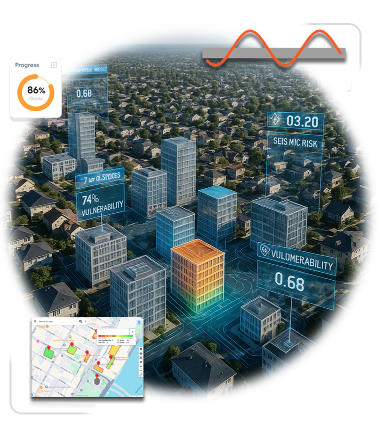
Empowering decision-makers in disaster management and emergency response through intelligent infrastructure inspection. We determine building and bridge vulnerability, delivering comprehensive reports and actionable recommendations for pre- and post-disaster scenarios. Our cloud platform provides structural analysis, reinforcement prioritization, generate maps and reports and interactive 3D mapping solutions.
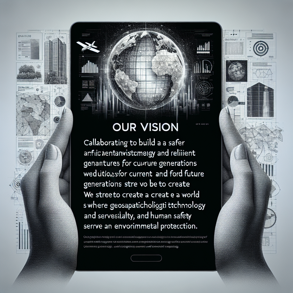
Our Vision
Collaborating to build a safer environment and resilient infrastructures for current and future generations. We strive to create a world where geospatial technology and artificial intelligence serve human safety and environmental protection.
The Complete Solutions
Integrated disaster (earthquake & flood) risk assessment platform powered by EO, DSS & AI technology
Smart Innovation
Advanced artificial intelligence and machine learning technology precise building vulnerability analysis against disaster (earthquake) with exceptional speed and accuracy levels.
Process Optimization
Complete automation of risk assessment process from rapid visual screening in the field and virtually to final report generation in minimal time with maximum operational efficiency.
Interactive Platform
Simple yet powerful user interface for image uploads, viewing three-dimensional risk maps and receiving practical reconstruction recommendations instantly.
Economic Efficiency
Reducing assessment costs up to fifty percent and processing time up to eighty percent while maintaining international quality standards with a minimum human resources.
Scientific Excellence
Based on FEMA standards and credible scientific research, awarded international life-saving solution of the year recognition from America.
Detection Accuracy
With possibility to advanced image recognition algorithms for precise identification of building types, materials and risk factors with minimal human error rates.
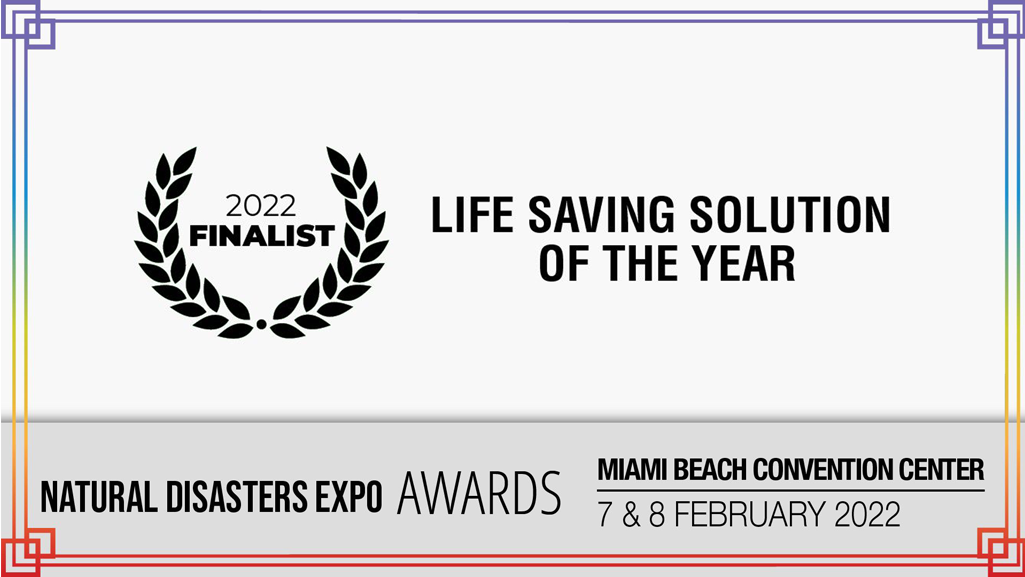
Life Saving Solution of The Year Award
This prestigious award recognizes innovators who deliver leading solutions in saving lives and minimizing losses before, during, and after natural disasters. Given the ever-present dangers posed by natural disasters worldwide, it is essential for industry leaders to embrace innovations that protect lives, spanning from global infrastructure projects to residential safety devices and beyond.
GeoIME proudly received this international recognition in 2022 from the Natural Disasters Expo Miami, USA.
For more information: https://www.thestormexpo.com/awards/
Advanced
Software Features
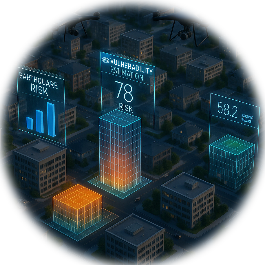
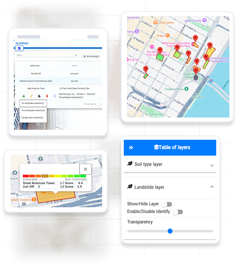
Geospatial rapid visual screening (GeoRVS) is sub-product of GeoIME, is an advanced earthquake risk assessment platform leveraging artificial intelligence and geospatial technologies. It enables rapid and precise vulnerability assessment of buildings and infrastructures virtually and in the field. Using thematic GIS layers, building attributes and spatial data analysis, the software assists decision-makers in designing optimal retrofitting and reconstruction plans. User-friendly interface and connectivity to professional engineers are among its key features.
Strategic Partners
Collaborating with technology leaders for innovative solutions worldwide
InspecTerra Inc.
InspecTerra Inc is our strategic partner in infrastructure condition assessment. This Canadian company, founded in 2016, specializes in non-destructive testing services for evaluating infrastructure assets including reinforced concrete structures, railway tracks, storage tanks, and surface and underground pipelines. Their patented iCAMM technology enables quantitative detection and mapping of corrosion and defects in ferromagnetic objects such as reinforcement steel below concrete surfaces. InspecTerra provides leading expertise in detailed bridge deck condition surveys, parking garage inspection, corrosion monitoring, risk assessment, and life cycle management. The company's innovative approach positions them as an emerging leader in the non-destructive testing sector. Visit www.inspecterra.com for more information.
LinKay Technologies
LinKay Technologies is our strategic partner in artificial intelligence and intelligent automation. This technology company, founded in 2010, specializes in developing and commercializing autonomous response systems powered by artificial intelligence. LinKay delivers innovative solutions using their proprietary and patented LinKay Ecosystem and LinKay GeoEngine across artificial intelligence, 3D mapping, smart mobility systems, and data security. The company focuses on optimizing infrastructure performance and transportation networks with advanced sensor technologies and autonomous operational management tools. With a team of leading scientists, engineers, and creative thinkers, LinKay is leading the race in AI technology development. Visit www.linkaytech.com for more information.
Vulnerability and estimation of risk, retrofitting
Geospatial Infrastructure Management Ecosystem (GeoIME)
- Intelligent platform for building vulnerability and risk assessment using AI technology
- 3D modeling and risk mapping for disaster management and damage reduction
Why choose
GeoIME?
Our advanced platform combines EO, GIS layers and building attributes leveraging artificial intelligence technology with specialized expertise to deliver comprehensive, all in one platform.
Earthquake risk assessment solutions that integrate speed, accuracy, and efficiency in one unified system.
Innovation
Advanced AI and machine learning technology for precise and rapid building vulnerability analysis using international FEMA standards and cutting-edge algorithms.
Quality
High accuracy in risk assessment with reduced human error, delivering comprehensive reports based on credible scientific data and international research.
Experience
Together, GeoIME team collected over 25 years of research and development experience in geospatial technologies and risk management, recognized with prestigious international awards.
Customer-First
User-friendly design with social engagement for both experts and non-experts with 24/7 support and comprehensive training for optimal platform utilization and maximum efficiency.
Everything in One Place
Research & Developer Team Mebmbers
GeoIME Team Years of Experience
Buildings Assessed in Beta
Expert Testimonials
More than 100 teams and researchers have used our services (pilot project) or participated in our scientific seminars and GeoRVS training. Read what these valued professionals say about us.
Very interesting!
“Very interesting! I like your geohazards. This is always a challenge for a particular site if no information (Geotech report, structural drawings, etc.) is readily available for the building site. Interesting approach!”

Michael J. Griffin, P.E.
CCS Group, Inc. www.ccsgroupstl.com
“As a structural engineer it is very interesting to me and I definitely see the value you are providing. I recall when the Christchurch New Zealand earthquake happened in 2011, surveying buildings was an enormous task and engineers from all over the world went and volunteered to carry out the work.”
Kanwar Johal, MASc., P.Eng.
Partnership Development www.superwake.ca
Any Questions? Look Here
Find answers to common questions about our platform
What services does GeoIME provide?
One of GeoIME's key solutions is Geospatial Rapid Visual Screening (GeoRVS), which determines building vulnerability and estimates risk both on-site and remotely through our advanced cloud platform.
How much geospatial knowledge do I need to evaluate my building?
You don't need any geospatial or GIS knowledge for Level 1 assessment (FEMA-154). Our platform is designed for both experts and non-experts to use effortlessly.
How do I create a GeoIME account?
Click "Get Started" on the main page. In the new window, select "Profile" in the top-right corner, provide your information, and submit to admin. You'll receive an activation email shortly after.
How do I use GeoIME services and connect with professional engineers?
Choose your desired service type and select a professional engineer from our list, or click "Professional Engineers Near Me" to find local experts. You can also email info@GeoRVS.com for inspector booking.
I'm having trouble accessing website samples. What should I do?
For issues with viewing samples or processing trial assessments, use the online chat at the bottom-right of the page or email info@GeoRVS.com. Our admin team will contact you within 2-3 business days.
I'm experiencing problems during building/bridge assessment. What should I do?
For assessment processing issues, use the online chat at the bottom-right of the page or email info@GeoRVS.com. Our admin office will contact you within 2-3 business days.