Infrastructure Safety Pioneer
We are a startup risk assessment software company aiming to create safer infrastructure including buildings and bridges for a safer and better world through innovative technology.
International expert team from academia and industry since 2007
Geospatial AI platform with 3D reconstruction computer vision modeling
About GeoIME
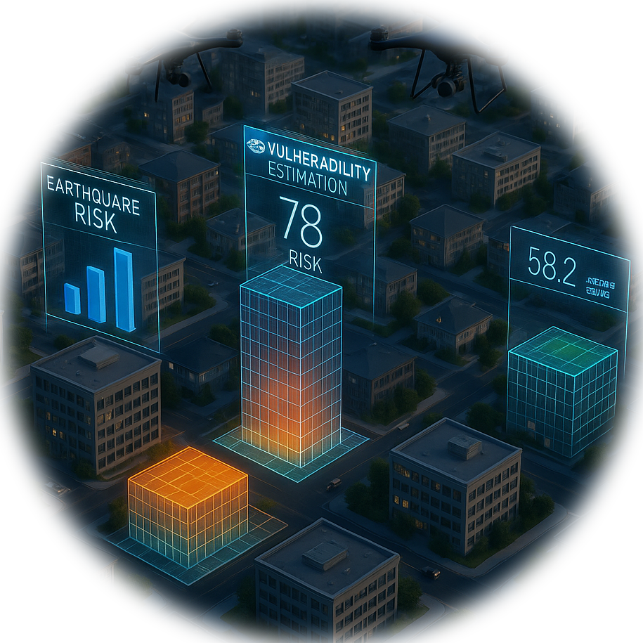
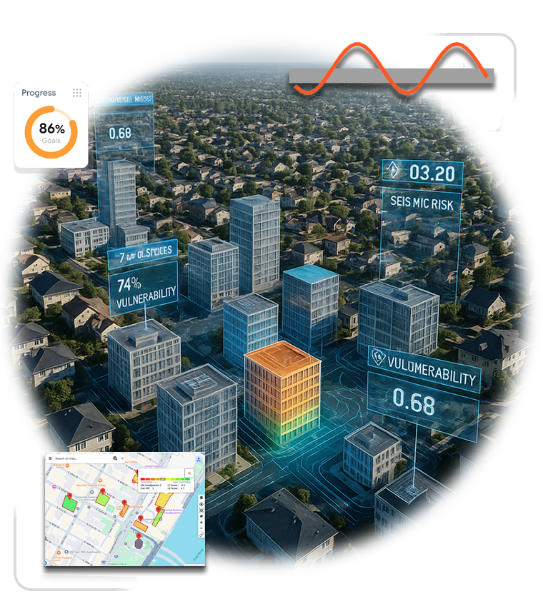
The Geospatial Infrastructure Management Ecosystem (GeoIME) is a comprehensive ecosystem designed to strengthen infrastructure resilience and create a more reliable environment. Geospatial Rapid Visual Screening (GeoRVS) is a subsidiary module of GeoIME that determines building vulnerability and estimates risk.


Our Mission
Our objective is to deliver user-friendly risk assessment and 3D reconstruction platforms to academicians, research & development professionals, practitioners, decision-makers, organizations, government bodies, and private companies. We believe that GeoIME can effectively contribute to the Sustainable Development Goals (SDGs) 2030 in an actionable, entrepreneurial, and innovative way.
develops software related to disaster risk management
What We Do
Core Services:
Determining building vulnerability and risk estimation for pre-and-post disasters (earthquakes) on-site and in office through web and cloud
Providing recommendations for building rehabilitation and reinforcement
Visualization, mapping, and 3D reconstruction
Customization and configuration based on targeted hazards and disasters
Advanced Technology:
Our platform offers customization, localization, and configuration capabilities with scalability based on targeted hazards and disasters for loss reduction, prevention, and mitigation in an intelligent monitoring system.
Expert Team
GeoIME is a building safety software with an international expert team partnership from academia and industry since 2007, with the privilege of developing an integrated geospatial information-based multidisciplinary GeoAI and 3D reconstruction computer vision modeling platform.

Co-founder & CEO
Dr. Adam-Saied Pirasteh
Ph.D., IEEE Senior Member
Dr. Pirasteh is an accomplished university professor, IEEE Senior Member, UN-GGIM-Academic Network Executive Committee member, and respected scientist with extensive involvement in advanced geospatial artificial intelligence (GeoAI) technologies. His experience spans across Canada, China, India, Malaysia, Thailand, and the USA.
Academic & Professional Background:
University Professor
Senior Scientist Collaborator at University of Waterloo
Lead Scientist at Linkay Technologies Inc. (2017-2019)
Education:
First Ph.D. in Geology (Remote Sensing and GIS) from AMU, India (2004)
Second Ph.D. in Geography (GeoAI) from University of Waterloo (2018)
Research Interests:
Geospatial Data Science & GeoAI, Remote Sensing Computer Vision (satellite, drone, LiDAR) and data processing, GIS and geospatial information analysis and modeling, and developing algorithms for novel applications in hazards & disasters.
Achievements and Volunteer Activities:
– Inventor and co-founder of GeoIME
– Over 300 publications
– Over 7,200 citation on Google Scholar with h-Index of 44
– Former UN-GGIM Academic Network Advisory Board (2020-2024)
– UN-GGIM Academic Network Executive Committee
– Associate Editor, IEEE TGRS
– Editor, Geoenvironmental Disasters, Remote Sensing
– ISPRS IVa Chair
– Chair of Canadian Institute of Geomatics (CIG) International Network
Commitment to
the Future
We believe in the importance of utilizing geospatial information for disaster risk reduction and emergency responses. Our goal is to create a safer world through innovative and accessible technologies.